
Southeast States and Capitals: A Study Guide
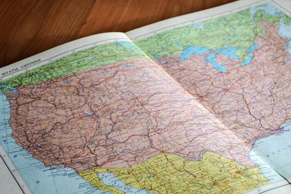
This guide utilizes detailed maps created with QGIS, leveraging data from Natural Earth, OpenStreetMap, and GeoNames for comprehensive regional study.
Explore the eleven southeastern states, their capitals, and UNESCO World Heritage Sites through visually rich, scalable maps – part of a larger US mapping project.
Welcome to a journey through the diverse and historically rich Southeastern United States! This region, encompassing eleven states, presents a fascinating study in geography, culture, and political organization. Understanding the Southeast requires more than just memorizing state names and capitals; it demands a spatial awareness fostered by detailed cartography.
This study guide aims to provide that spatial understanding. We will explore the region through the lens of meticulously crafted maps, built using powerful Geographic Information System (GIS) software – QGIS – and drawing upon authoritative data sources like Natural Earth, OpenStreetMap, and GeoNames. These resources allow for the creation of highly accurate and informative visualizations.
The maps aren’t simply static images; they are components of a larger project to map entire continents at a scale of 1:2,500,000, offering a unique perspective on the interconnectedness of geographical features and political boundaries. We’ll focus on regional areas, eventually integrating into broader continental views.
Defining the Southeast Region
Geographically and culturally, defining the “Southeast” isn’t always straightforward. Generally, it includes states bordering the Atlantic Ocean and Gulf of Mexico, extending westward to the Mississippi River. However, definitions can vary based on criteria like climate, historical ties, and economic factors.
For the purpose of this guide, we’ll focus on the eleven states commonly recognized as part of the region: Alabama, Arkansas, Florida, Georgia, Kentucky, Louisiana, Mississippi, North Carolina, South Carolina, Tennessee, and West Virginia. These states share commonalities in their history – particularly regarding the plantation system and the Civil War – and a subtropical climate in many areas.
Our cartographic approach utilizes data-driven boundaries, visualized through QGIS, ensuring a consistent and accurate representation of the region. The maps, built with Natural Earth and OpenStreetMap data, provide a clear visual framework for understanding the Southeast’s spatial extent and internal diversity.
Geographical Characteristics of the Southeast
The Southeast boasts remarkable geographical diversity. From the Appalachian Mountains in the north to the coastal plains and Gulf Coast, the landscape is varied. Significant features include the Piedmont plateau, fertile river valleys (Mississippi, Tennessee, Savannah), and extensive wetlands, particularly in Florida and Louisiana.
These features are clearly depicted in the maps created using QGIS and data from Natural Earth. Shaded relief highlights the mountainous regions, while color gradients illustrate elevation changes. River networks, sourced from OpenStreetMap, showcase the region’s hydrological systems.
The climate is largely humid subtropical, with hot summers and mild winters, though variations exist. Coastal areas are prone to hurricanes, while inland regions experience more seasonal temperature swings. Understanding these geographical characteristics is crucial when studying the region’s capitals and states.
The Eleven Southeast States
The Southeastern United States encompasses eleven diverse states: Alabama, Arkansas, Florida, Georgia, Kentucky, Louisiana, Mississippi, North Carolina, South Carolina, Tennessee, and Virginia, plus West Virginia. Each state possesses unique geographical features, historical backgrounds, and economic drivers.
Detailed maps, constructed with QGIS and data from Natural Earth, OpenStreetMap, and GeoNames, visually represent these states’ boundaries and key cities. These maps are part of a larger project aiming to map the entire continent at a scale of 1:2,500,000.
Studying these states requires understanding their individual characteristics, which are readily apparent through the map’s detailed representation of towns, cities, and geographical landmarks. UNESCO World Heritage Sites are also highlighted, offering points of cultural and natural interest.
Alabama: Key Facts and Capital
Alabama, nicknamed the “Heart of Dixie,” is a southeastern state known for its rich history, diverse landscapes, and significant role in the Civil Rights Movement. Its economy is driven by industries like aerospace, agriculture, and manufacturing.
Montgomery proudly serves as Alabama’s state capital. Detailed maps, created using QGIS with data from Natural Earth, OpenStreetMap, and GeoNames, pinpoint Montgomery’s location and surrounding geographical features. These maps contribute to a larger project mapping the entire United States at a 1:2,500,000 scale.
Studying Alabama through these maps reveals its urban centers and natural attractions, including UNESCO World Heritage Sites within the region. The map’s precision aids in understanding the state’s spatial relationships and key landmarks.
Arkansas: Key Facts and Capital
Arkansas, known as the “Natural State,” boasts a diverse geography encompassing the Ozark Mountains, fertile delta regions, and the Mississippi River. Its economy relies heavily on agriculture – particularly rice and poultry – alongside industries like forestry and tourism.
Little Rock functions as Arkansas’s state capital and most populous city. Detailed maps, meticulously crafted with QGIS utilizing data from Natural Earth, OpenStreetMap, and GeoNames, accurately depict Little Rock’s position and surrounding terrain. These maps are integral to a broader initiative aiming to map the entire US at a 1:2,500,000 scale.
Analyzing Arkansas via these maps highlights its key cities, natural resources, and UNESCO World Heritage Sites. The map’s accuracy enhances understanding of the state’s spatial organization and significant locations.
Florida: Key Facts and Capital
Florida, the “Sunshine State,” is renowned for its subtropical climate, extensive coastline, and vibrant tourism industry. Its economy is driven by tourism, agriculture (citrus fruits, vegetables), and a growing aerospace sector. Unique ecosystems like the Everglades define much of its landscape.
Tallahassee serves as Florida’s capital city, strategically located in the northern part of the state. Detailed maps, generated using QGIS and data from Natural Earth, OpenStreetMap, and GeoNames, precisely illustrate Tallahassee’s location and the surrounding geographical features. These maps contribute to a larger project mapping the US at a 1:2,500,000 scale.
Studying Florida through these maps reveals its diverse geography, major cities, and UNESCO World Heritage Sites, enhancing spatial understanding of this unique state.
Georgia: Key Facts and Capital
Georgia, the “Peach State,” boasts a diverse economy encompassing agriculture (peaches, pecans, poultry), film production, and logistics, particularly through its bustling port in Savannah. Historically significant, Georgia played a crucial role in the Civil Rights Movement and the Civil War. Its landscape ranges from coastal plains to the Appalachian Mountains.
Atlanta functions as Georgia’s capital and largest city, a major transportation hub and cultural center. Detailed maps, crafted with QGIS utilizing Natural Earth, OpenStreetMap, and GeoNames data, accurately depict Atlanta’s position and the state’s geographical characteristics. These maps are part of a larger mapping initiative aiming for a 1:2,500,000 scale across the United States.
Analyzing Georgia via these maps highlights its key features, including UNESCO World Heritage Sites, fostering a deeper geographical comprehension.
Kentucky: Key Facts and Capital
Kentucky, known as the “Bluegrass State,” is famed for its horse farms, bourbon distilleries, and the Kentucky Derby. Its economy relies heavily on agriculture, automotive manufacturing, and tourism, drawing visitors to Mammoth Cave National Park and the scenic Appalachian region. Historically, Kentucky was a crucial border state during the Civil War.
Frankfort serves as Kentucky’s capital, a city steeped in history situated on the Kentucky River. Detailed maps, generated using QGIS and data from Natural Earth, OpenStreetMap, and GeoNames, precisely locate Frankfort and illustrate the state’s varied topography. These maps contribute to a broader project mapping the entire United States at a 1:2,500,000 scale.
Studying Kentucky through these maps reveals its geographical nuances and the location of UNESCO World Heritage Sites, enhancing regional understanding.
Louisiana: Key Facts and Capital
Louisiana, the “Pelican State,” is renowned for its unique cultural blend of French, Spanish, and African influences, particularly evident in New Orleans. Its economy centers around energy (oil and gas), agriculture (sugarcane, soybeans), and tourism, attracting visitors to its vibrant music scene and bayous. The state’s geography is dominated by the Mississippi River Delta and coastal wetlands.
Baton Rouge functions as Louisiana’s capital, a major port city on the Mississippi River. Detailed maps, crafted with QGIS utilizing Natural Earth, OpenStreetMap, and GeoNames data, accurately pinpoint Baton Rouge and showcase Louisiana’s complex waterways. These maps are part of a larger initiative to map the US at a 1:2,500,000 scale.
Mapping Louisiana reveals its geographical features and the locations of UNESCO sites, aiding in a comprehensive regional study.
Mississippi: Key Facts and Capital
Mississippi, known as the “Magnolia State,” holds a significant place in American history, particularly regarding the Civil Rights Movement and blues music. Its economy historically relied on agriculture – cotton being a key crop – but has diversified into manufacturing and services. The state’s landscape is characterized by fertile plains and rolling hills.
Jackson serves as Mississippi’s capital city, a hub for government, commerce, and culture. Detailed maps, generated using QGIS and data from Natural Earth, OpenStreetMap, and GeoNames, precisely locate Jackson and illustrate Mississippi’s river systems and terrain. These maps contribute to a larger project aiming to map the entire United States at a detailed scale.
Visualizing Mississippi through these maps enhances understanding of its geography and the placement of important landmarks and UNESCO World Heritage Sites.

North Carolina: Key Facts and Capital
North Carolina, the “Tar Heel State,” boasts a diverse geography ranging from the Atlantic coastline to the Appalachian Mountains. Its economy is a blend of finance, technology, and agriculture, with a growing film industry. Historically, it played a crucial role in the American Revolution and the Civil War.
Raleigh is North Carolina’s vibrant capital city, known for its universities, research parks, and cultural attractions. Detailed maps, created with QGIS utilizing Natural Earth, OpenStreetMap, and GeoNames data, accurately depict Raleigh’s location and the state’s varied topography. These maps are part of a larger mapping initiative covering the entire United States.
Studying North Carolina through these detailed maps provides a visual understanding of its geographical features and the placement of UNESCO World Heritage Sites within the region.
South Carolina: Key Facts and Capital

South Carolina, known as the “Palmetto State,” is steeped in history and renowned for its beautiful coastline, including barrier islands and beaches. Its economy relies heavily on tourism, agriculture (particularly peaches and tobacco), and manufacturing, including aerospace and automotive industries. The state played a significant role in the Civil War, being the first to secede from the Union.
Columbia serves as South Carolina’s capital city, a hub for government, education, and culture; Detailed maps, generated using QGIS and data from Natural Earth, OpenStreetMap, and GeoNames, showcase Columbia’s position and the state’s geographical characteristics. These maps contribute to a larger project aiming to map the entire United States at a 1:2,500,000 scale.
Visualizing South Carolina through these maps enhances understanding of its landscape and the location of UNESCO World Heritage Sites.
Tennessee: Key Facts and Capital
Tennessee, the “Volunteer State,” boasts a diverse landscape ranging from the Appalachian Mountains to the Mississippi River Valley. Music is central to its identity, particularly country, blues, and rock ‘n’ roll, with Nashville as its epicenter. The state’s economy is driven by manufacturing, agriculture (soybeans, cotton, and livestock), and tourism, attracting visitors to the Great Smoky Mountains National Park and musical landmarks.
Nashville proudly serves as Tennessee’s capital, a vibrant city celebrated for its music scene and growing economy. Detailed maps, created with QGIS utilizing Natural Earth, OpenStreetMap, and GeoNames data, accurately depict Nashville’s location and Tennessee’s overall geography. These maps are part of an ambitious project to map the entire US at a 1:2,500,000 scale.
Mapping Tennessee provides a visual context for understanding its unique features and UNESCO World Heritage Sites.
Virginia: Key Facts and Capital
Virginia, often called the “Old Dominion,” holds a significant place in American history, being the site of the first permanent English settlement in North America at Jamestown. Its economy is diverse, encompassing federal employment, military installations (like the Pentagon), agriculture (tobacco, soybeans, and poultry), and tourism. The state’s landscape varies dramatically, from the Atlantic coastline to the Blue Ridge Mountains.
Richmond functions as Virginia’s capital, a city steeped in history and undergoing modern revitalization. Detailed maps, constructed using QGIS and data from Natural Earth, OpenStreetMap, and GeoNames, precisely illustrate Richmond’s position and Virginia’s geographical characteristics. These maps contribute to a larger project aiming to map the entire United States at a 1:2,500,000 scale.
Visualizing Virginia through mapping enhances understanding of its historical importance and geographical diversity.
West Virginia: Key Facts and Capital

West Virginia, admitted to the Union during the Civil War, is characterized by its rugged mountainous terrain and abundant natural resources, historically centered around coal mining. Today, tourism, driven by outdoor recreation like hiking and whitewater rafting, plays an increasingly vital role in its economy. The state boasts significant forested areas and a rich Appalachian culture.
Charleston serves as West Virginia’s capital, situated along the Kanawha River. Detailed cartography, utilizing QGIS and datasets from Natural Earth, OpenStreetMap, and GeoNames, accurately depicts Charleston’s location and the state’s complex topography. These maps are part of an ambitious project to map the entire United States at a scale of 1:2,500,000.
Mapping West Virginia provides a valuable tool for understanding its unique geographical features and economic landscape.
Southeast Capitals: A Closer Look
The southeastern capitals, meticulously mapped using QGIS and data from Natural Earth, OpenStreetMap, and GeoNames, offer a fascinating study in regional diversity and historical development. These cities aren’t merely administrative centers; they are hubs of culture, commerce, and political influence, each reflecting the unique character of its state.
Detailed cartography reveals the geographical context of each capital, showcasing their location relative to major rivers, mountain ranges, and transportation networks. The project aims for a 1:2,500,000 scale, creating regional maps (2900×1950 km) that contribute to larger continental overviews (8700×3150 km).
Exploring these capitals through detailed maps enhances understanding of the Southeast’s complex regional identity.
Montgomery, Alabama
Montgomery, Alabama’s state capital, is precisely located on detailed maps created with QGIS, utilizing data sourced from Natural Earth, OpenStreetMap, and GeoNames. This cartographic representation showcases its position within the state and the broader Southeastern landscape, highlighting key geographical features influencing its development.
As part of a larger mapping project aiming for a 1:2,500,000 scale, Montgomery’s inclusion on the 2900×1950 km regional map contributes to a comprehensive understanding of the Southeast. The city’s coordinates, verified through GeoNames and Wikipedia, ensure accuracy.
Further map enhancements could include cultural or natural sites of interest, alongside existing UNESCO World Heritage Site markers.
Little Rock, Arkansas
Little Rock, the capital of Arkansas, is meticulously positioned on maps generated using QGIS software, integrating data from Natural Earth, OpenStreetMap, and GeoNames. These resources provide a detailed and accurate depiction of the city’s location within the southeastern United States, showcasing its geographical context.
As a component of a larger cartographic endeavor – a project aiming to map continents at a 1:2,500,000 scale – Little Rock’s inclusion on the regional map (2900×1950 km) contributes to a broader understanding of the region. Coordinate accuracy is ensured via GeoNames and Wikipedia verification.
Potential map additions could feature local attractions, complementing the currently marked UNESCO World Heritage Sites.
Tallahassee, Florida
Tallahassee, the capital of Florida, is precisely located on detailed maps crafted with QGIS, utilizing publicly available data from Natural Earth and OpenStreetMap. The city’s coordinates are verified using GeoNames and Wikipedia, ensuring accuracy within the broader southeastern United States map.
This map, measuring 2900×1950 km, forms part of an ambitious project to map entire continents at a 1:2,500,000 scale. Tallahassee’s inclusion contributes to a larger map encompassing the entire United States, offering regional context.
Suggestions for enhancing the map are welcome, including the addition of cultural or natural sites of interest, alongside the currently displayed UNESCO World Heritage Sites.
Atlanta, Georgia
Atlanta, Georgia’s vibrant capital, is meticulously positioned on maps generated using QGIS software. These maps integrate data sourced from Natural Earth, providing foundational geographic features, and OpenStreetMap, offering detailed local information; Precise city coordinates are cross-referenced with GeoNames and Wikipedia for verification.
As part of a larger cartographic endeavor, this 2900×1950 km regional map will eventually connect with others to create a comprehensive map of the entire United States. The project aims for a 1:2,500,000 scale, offering exceptional detail.
Feedback is encouraged regarding potential additions, such as cultural landmarks or natural attractions, alongside the existing UNESCO World Heritage Site markers.
Frankfort, Kentucky
Frankfort, the capital of Kentucky, is accurately represented on detailed maps crafted with QGIS, a free and open-source geographic information system. The map’s foundation relies on data from Natural Earth, providing essential background layers and terrain features, complemented by the dynamic contributions of OpenStreetMap.
Precise location data for Frankfort is verified using GeoNames and Wikipedia, ensuring cartographic accuracy. This regional map, measuring 2900×1950 km, is part of an ambitious project to map entire continents at a 1:2,500,000 scale.
Suggestions for incorporating additional points of interest – cultural sites or natural wonders – are welcome, alongside the currently marked UNESCO World Heritage Sites.
Baton Rouge, Louisiana
Baton Rouge, Louisiana’s vibrant capital city, is meticulously depicted on maps generated using QGIS software. These maps integrate data from Natural Earth, offering foundational geographic elements, and OpenStreetMap, providing up-to-date feature details. Precise coordinates for Baton Rouge are cross-referenced with GeoNames and Wikipedia to guarantee accuracy.
This detailed regional map, part of a larger continental mapping initiative, aims for a scale of 1:2,500,000, with dimensions of 2900×1950 km. It will eventually connect with larger maps covering the entire United States.
Feedback regarding potential errors or suggestions for adding cultural or natural attractions is encouraged, alongside the existing UNESCO World Heritage Site markers.
Jackson, Mississippi
Jackson, the capital of Mississippi, is accurately represented on detailed maps created with QGIS, a free and open-source geographic information system. The map’s foundation relies on data sourced from Natural Earth, providing essential background layers and geographic features. Complementing this, OpenStreetMap contributes current information on roads and points of interest.
Precise location data for Jackson is verified using GeoNames and Wikipedia, ensuring cartographic accuracy. This regional map, measuring 2900×1950 km, is part of a larger project aiming to map the entire United States at a 1:2,500,000 scale.
Suggestions for additional sites of interest, whether cultural or natural, are welcome to enhance the map’s utility.
Raleigh, North Carolina
Raleigh, the capital city of North Carolina, is meticulously positioned on a detailed map constructed using QGIS software. This map benefits from a robust data foundation, primarily utilizing Natural Earth for base layers, shaded relief, and road networks – all public domain resources.
OpenStreetMap provides up-to-date information regarding the city’s infrastructure and points of interest, while GeoNames and Wikipedia ensure the accuracy of Raleigh’s geographic coordinates. This regional map, part of a larger continental project, aims for a 1:2,500,000 scale.
Feedback and suggestions regarding potential additions, such as cultural or natural landmarks, are encouraged to improve the map’s comprehensive nature.
Columbia, South Carolina
Columbia, the capital of South Carolina, is precisely located on a detailed map created with QGIS, a free and open-source mapmaking software. The map’s accuracy relies on data sourced from Natural Earth, providing foundational geographic features like terrain and roadways.
OpenStreetMap contributes current data on the city’s layout and points of interest, complemented by coordinate information from GeoNames and Wikipedia. This regional map, designed at a scale of 1:2,500,000, is part of a larger project aiming to map the entire United States.
UNESCO World Heritage Sites are highlighted, and suggestions for additional cultural or natural attractions are welcomed to enhance the map’s utility.
Nashville, Tennessee
Nashville, the vibrant capital of Tennessee, is meticulously positioned on a detailed map constructed using QGIS software. This map benefits from a robust data foundation, primarily sourced from Natural Earth, offering comprehensive geographic features and shaded relief.
OpenStreetMap provides up-to-date information regarding Nashville’s urban structure and local points of interest, while GeoNames and Wikipedia ensure accurate city coordinates. As part of a larger continental mapping initiative, this regional map is designed for a scale of 1:2,500,000.

UNESCO World Heritage Sites are visually represented, and user suggestions for additional sites – cultural or natural – are encouraged to improve the map’s educational value.
Richmond, Virginia
Richmond, the historical capital of Virginia, is precisely located on a detailed map created with QGIS, a free and open-source mapmaking software. The map’s accuracy relies on data from Natural Earth, providing foundational geographic features and terrain details.
OpenStreetMap contributes current urban data, including roads and local landmarks, while GeoNames and Wikipedia ensure the correct coordinates for the city. This map is part of an ambitious project aiming to map entire continents at a 1:2,500,000 scale.
UNESCO World Heritage Sites within the region are highlighted, and suggestions for adding other points of interest – both cultural and natural – are welcomed to enhance the map’s utility.
Charleston, West Virginia
Charleston, the capital of West Virginia, is meticulously positioned on a detailed map constructed using QGIS software. This map benefits from the public domain data provided by Natural Earth, offering a robust base for geographical features and shaded relief.
OpenStreetMap contributes up-to-date information on roads and urban areas, while GeoNames and Wikipedia ensure precise city coordinates. This cartographic effort is part of a larger project intending to map continents at a 1:2,500,000 scale, creating regional maps of 2900×1950 km.
UNESCO World Heritage Sites are visually represented, and user feedback is encouraged for adding cultural or natural attractions to further enrich the map’s educational value.
Mapping the Southeast: Resources and Tools
Studying the Southeast benefits greatly from utilizing powerful mapping resources. QGIS, a free and open-source software, is central to creating detailed maps, leveraging data readily available from Natural Earth. This platform allows for the preparation of map templates, incorporating public domain features like background layers and shaded relief.
OpenStreetMap provides constantly updated information on roads and urban development, while GeoNames and Wikipedia offer precise geographical coordinates for cities and towns. These resources are combined to achieve a 1:2,500,000 scale, contributing to a larger continental mapping project.
The ultimate goal is to create maps spanning 2900×1950 km and larger 8700×3150 km areas, covering entire regions and subcontinents.
Utilizing Online Map Resources (Natural Earth, OpenStreetMap, GeoNames)
For detailed Southeast mapping, several online resources prove invaluable. Natural Earth provides public domain map data, including background features, shaded relief, and road networks – forming the foundational template for regional maps. OpenStreetMap contributes constantly updated information on infrastructure and urban areas, ensuring map accuracy.
Precise location data for cities and towns is sourced from GeoNames and cross-referenced with Wikipedia. This combination allows for accurate placement of state capitals and other points of interest. These resources facilitate map creation at scales like 1:2,500,000, supporting a larger project to map entire continents.
Remember to check for errors and suggest additions!
QGIS for Map Creation and Study
QGIS, a free and open-source Geographic Information System, is central to creating detailed maps of the Southeastern United States. It serves as the software for preparing map templates, initially blank canvases awaiting geographical data. Natural Earth data is heavily utilized within QGIS, leveraging its public domain status for background layers, relief shading, and road networks.
The software allows integration of data from OpenStreetMap and location coordinates from GeoNames, enhancing map accuracy and detail. QGIS facilitates the creation of maps at specific scales, such as 2900×1950 km for regional views, contributing to a larger continental mapping project. It’s a powerful tool for both map creation and in-depth geographical study.
UNESCO World Heritage Sites in the Southeast
The Southeastern United States boasts a rich cultural and natural heritage, recognized globally through UNESCO World Heritage Site designations. These significant locations are visually represented on detailed maps using yellow boxes, highlighting their importance within the region. Mapping these sites provides a valuable layer for study, showcasing the area’s historical and ecological treasures.
Currently, the maps focus specifically on UNESCO sites, acknowledging the vast number of potential points of interest. Further development may include cultural landmarks and natural attractions, based on user suggestions. This selective inclusion allows for a focused exploration of internationally recognized sites, enriching the overall study guide experience.